Last beach of the state before the border with ParaŪba state, Sagi is a tupi name of a crustacean. It is formed by a practically deserted strip of sand with a strong sea.
The beach is lined with beautiful dunes with vegetation which hide a beautiful region of mangroves and lakes. The most beautiful is 'lagoa de coca-cola' situated between Sagi and Baia Formosa, called like that for its dark water.
Before arriving at Sagi, the visitor will cross big fields of sugar cane, one of the biggest agricultural productions of the state, which has its history connected to the development of the state.
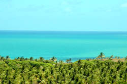
By moving on the beach you can admire the sea colors varying from emerald green into turquoise blue.
Sagi is also a protection area of a threatened mammal known as 'Sea Cow', the Manatee.
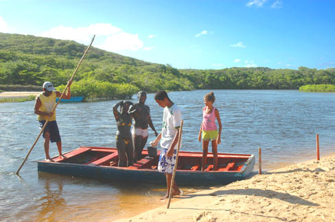
You can also admire the beauty of the river 'Guaju' on the border with ParaŪba state.
Municipality : Baia Formosa Distance from Natal : 105 km
How to come : Access by the BR101 then 2 km after Outeiros take the RN314
Sagi occupied by Indians Tupi, saw the passage of the French fleets in the XVIth century, and had a later development, with the construction of a chapel in 1971, allowing the formation of a real village.
The village of Sagi keeps all the characteristics of a traditional fishermen village, located on a place where the nature is still protected.
You can find there some restaurants in Sagi or isolated on the long beach, which will delight the lover of peaceful and ecological tourism.


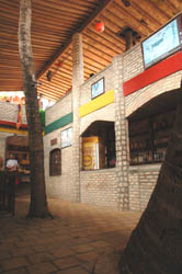
 Where to eat and drink